A high-sensitivity GPS receiver acts as the critical data acquisition engine within intelligent navigation assistance systems for wearables. Its primary function is to capture and supply the wearer's real-time spatial coordinates and orientation, serving as the foundational input for all pathfinding operations.
The high-sensitivity GPS receiver transforms a wearable device from a passive accessory into an active guide. By feeding precise location data into GIS (Geographic Information System) interfaces, it enables the system to calculate the shortest walking paths and provide real-time, turn-by-turn direction to specific destinations.
The Bridge Between Location and Logic
Real-Time Spatial Awareness
The immediate role of the receiver is to maintain a constant lock on the user's position. It continuously updates the real-time spatial coordinates of the wearer.
Beyond simple latitude and longitude, the receiver also helps determine orientation. This ensures the system knows not only where the user is standing, but also which direction they are facing.
Integration with GIS Databases
Raw GPS data is effectively useless for navigation without context. The receiver works in direct conjunction with GIS database interfaces.
This integration maps the user's coordinates against a digital framework of the real world. It allows the system to understand where the user is relative to streets, obstacles, and landmarks.
Enabling Advanced Path Planning
Calculating the Optimal Route
Once the location is established, the system leverages the GPS data to support path planning functions.
Specifically, the system utilizes the wearer's current position to calculate the shortest walking path to a desired location. This maximizes efficiency and reduces physical strain on the user.
Dynamic Destination Guidance
The GPS receiver enables the system to guide users to two distinct types of locations.
First, it supports user-defined destinations, allowing for custom navigation based on specific needs. Second, it can guide users to general points of interest or reference locations embedded in the database.
Driving User Feedback
The ultimate output of this data chain is communication. The position and path data drive voice or other feedback systems.
This provides the user with audible or haptic cues, translating complex spatial calculations into simple, actionable instructions.
Understanding the System Dependencies
The GPS-GIS Symbiosis
It is critical to understand that the GPS receiver cannot function in isolation. Its utility is entirely dependent on the quality of the GIS database interface.
If the GPS provides high-sensitivity data but the GIS database is outdated or lacks detail, the path planning functions will fail.
The Sensitivity Requirement
The reliance on "high-sensitivity" receivers is not accidental. Wearables are often used in environments where signal blockage is common (such as urban canyons or near tall buildings).
A standard receiver might lose lock, breaking the link between the user's position and the path planning logic.
Making the Right Choice for Your Goal
When evaluating wearable navigation technology, the value of the GPS receiver depends on your specific application requirements.
- If your primary focus is efficiency: Prioritize systems where the GPS updates frequently to ensure the shortest walking path is recalculated instantly if the user deviates.
- If your primary focus is user accessibility: Ensure the GPS integrates seamlessly with voice feedback systems to provide clear, hands-free guidance to points of interest.
The high-sensitivity GPS receiver is the heartbeat of modern wearable navigation, turning static maps into dynamic, user-centric guidance tools.
Summary Table:
| Feature | Role in Wearable Navigation | Impact on User Experience |
|---|---|---|
| Spatial Coordinates | Captures real-time latitude, longitude, and orientation. | Foundation for accurate location tracking. |
| GIS Integration | Maps raw GPS data against digital real-world frameworks. | Contextualizes position relative to landmarks. |
| Path Planning | Calculates the shortest walking paths dynamically. | Maximizes navigation efficiency and speed. |
| Feedback Systems | Drives voice and haptic feedback alerts. | Enables hands-free, turn-by-turn guidance. |
| High Sensitivity | Maintains signal lock in urban canyons or dense areas. | Ensures uninterrupted guidance in challenging environments. |
Elevate Your Wearable Solutions with 3515 Footwear Expertise
As a large-scale manufacturer serving global distributors and brand owners, 3515 offers comprehensive production capabilities for all footwear types, anchored by our flagship Safety Shoes series.
Whether you are integrating smart wearable technology into tactical boots, outdoor gear, or training sneakers, our extensive portfolio covers work and tactical boots, outdoor shoes, training shoes, and sneakers, as well as Dress & Formal shoes to meet your diverse bulk requirements.
Ready to bring high-performance footwear to your market? Contact us today to discuss your bulk production needs and explore how our manufacturing excellence can add value to your brand.
References
- Shripad Bhatlawande, Swati Shilaskar. A Smart Clothing Approach for Augmenting Mobility of Visually Impaired People. DOI: 10.1109/access.2024.3364915
This article is also based on technical information from 3515 Knowledge Base .
Related Products
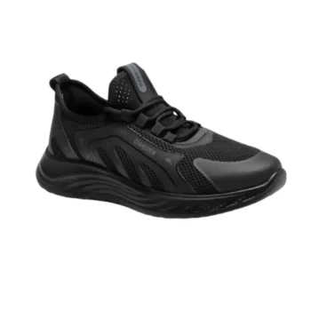
- Lightweight Breathable Sneakers with Wet-Traction Grip for Wholesale & Private Label
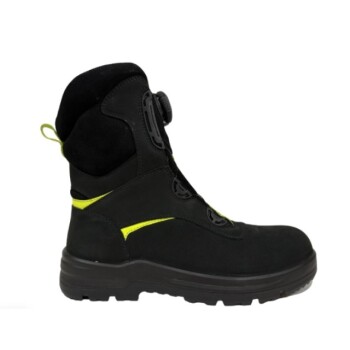
- Durable High-Ankle Tactical Boots Wholesale Manufacturer for Custom & Bulk Orders
- Wholesale Durable Safety Boots Manufacturer Customizable Steel Toe Work Boots
- Wholesale Tactical Boots High-Traction & Reflective for Bulk & Brand Orders
- Durable Leather Moc Toe Work Boots for Wholesale & Custom Manufacturing
People Also Ask
- How do lightweight shoes contribute to healthier feet? Reduce Fatigue & Prevent Foot Problems
- Why is breathability important in shoes for all-day wear? Prevent Sweat, Blisters, and Fatigue
- Why are breathable sneakers necessary for tropical commuting? Stay Cool and Dry in High Humidity
- What are the style advantages of lightweight shoes? Sleek, Versatile & Modern Comfort
- How do lightweight shoes improve breathability? Discover the Science of Cool, Dry Feet